Tuesday, June 30, 1998 (Continued)
Continued on the Alaska Highway - stopped at Rancheria Falls - more of a cascade and not very tall.

Rancheria Falls, Yukon Territory

Rancheria Falls, Yukon Territory

Nisutlin Bay Bridge, Yukon Territory
Crossed the Continental Divide shortly after noon - drains west to the Yukon River 2300 miles to the Pacific Ocean - and east to the Laird River 2650 miles to the Arctic Ocean.
Stopped at the Nisutlin Bay Bridge - longest water span on the Alaska Highway.
Stopped at several viewpoints along Teslin Lake which is 84 miles long and averages two miles wide.

Teslin Lake, Yukon Territory

Teslin Lake, Yukon Territory
Made camp at the Squanga Lake Yukon Government Campground.
Wednesday, July 1, 1998
Today is Canada Day (like our Fourth of July) and started out overcast but soon became sunny and hot.
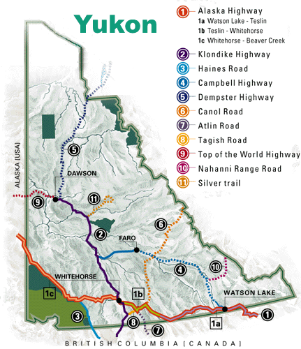
I continued up the Alaska Highway, then at Jake's Corner turned south on a side trip to Atlin, BC. The first 40 miles was very smooth gravel road, then 18 miles of paved road. They were starting work on paving another section.
Along the way to Atlin, passed two interestingly named campgrounds. Snafu Lake Campground and Tarfu Lake Campground.
Snafu means "Situation Normal — All 'Fouled' Up." This was 1 of 2 forest fire crew camps in the late 1950s. Tarfu means "Things Are Really 'Fouled' Up." The US army spent almost half a million dollars to construct the camps. They took them down after finishing the Atlin Road.

Interesting 'SNAFU' name, near Jake's Corner, Yukon Territory

Interesting 'TARFU' name, near Jake's Corner, Yukon Territory
Atlin Lake at 307 square miles is the largest natural lake in British Columbia. The town of Atlin dates from 1898 gold rush times and is called shangri-la by some.
Very pretty setting with several glaciers on the mountains across the lake. They have a dry-docked boat that was built at Atlin to haul cargo across the lake before the road. It was built in 1917 and operated until 1936 - a gasoline driven twin propeller wood hull.

Dry docked 1917 boat in Atlin, British Columbia
While I was busy taking pictures they had a Canada Day Parade - complete with marchers, floats (of a sort), fire engines with sirens, etc. - just like Fourth of July in Independence or Lone Pine or many other small rural towns.
While I was taking pictures a local puppy picked up a stick and swam across part of the lake - delivered the stick to me and clearly wanted me to toss it - being a sucker, I did. He returned the stick for another toss - jumping up and down, very excited - and wet. Just like the "pine cone" puppy at home.
After several tosses, I stopped. He kept dropping the stick in front of me, I'd walk past it, he'd pick it up and move it forward, etc. etc. Finally he started yelping - having a temper tantrum. Then he tried another person - who got suckered in - but only once.
This man was with his wife and another couple - each driving their own medium sized motor home - that I had talked to earlier in the day at a viewpoint. They were from Vancouver and on their way to Alaska. They had been to Death Valley and knew where Bishop was. Small world.
Drove out the Discovery Road to Surprise Lake. Along the stream bed there has been a lot of gold mining with bulldozers - looked sort of like the results of river dredges but the piles of rock were too big and dredges never worked the area.
Drove out the Warm Bay Road which parallels the shore of Atlin Lake. Fine views of the Llewellyn Glacier across the lake. A small undeveloped warm spring near the end and several small campgrounds.

Atlin Lake, British Columbia>

Atlin Lake, British Columbia

Mount Minto, Atlin Lake, British Columbia

Atlin Lake, British Columbia

Atlin Lake, British Columbia

Atlin Lake, British Columbia

Atlin, British Columbia

Atlin Mountain, Atlin Lake, British Columbia

Atlin Lake, British Columbia

Atlin Lake, British Columbia
, Birch Mtn (right) and Atlin Lake, British Columbia")
South Lake (foreground), Birch Mtn (right) and Atlin Lake, British Columbia

Llewellyn Glacier across Atlin Lake, British Columbia

Atlin Lake, British Columbia

Llewellyn Glacier across Atlin Lake, British Columbia
I retreated back to Jake's Corner and took the Tagish Road which would eventually take me over to the Klondike Highway to Skagway. Stopped at the Tagish Lake Campground, Yukon Territory.
Walked down to the Six Mile River bank and saw an Eagle in flight. It landed in a tree so I went back to get my camera - hoping it would still be there - it wasn't, so I took some pictures of sea gulls instead.

Sea Gull at Six Mile River near Tagish Campground, Yukon Territory

Sea Gull at Six Mile River near Tagish Campground, Yukon Territory

Sea Gull at Six Mile River near Tagish Campground, Yukon Territory

Sea Gull at Six Mile River near Tagish Campground, Yukon Territory

Sea Gull at Six Mile River near Tagish Campground, Yukon Territory

Sea Gull at Six Mile River near Tagish Campground, Yukon Territory
Thursday, July 2, 1998
Clear sunny day - not a cloud to be seen.
Headed over to the Klondike Highway and stopped at Carcross, YT. The Visitor Centre is in the railroad station for the White Pass and Yukon Railroad. This historic narrow gauge line currently runs excursions from Skagway to White Pass Summit and back.
At the time of my visit in 1998, the track from White Pass on to Carcross and eventually Whitehorse was being refurbished and it was planned for the entire route to be run. UPDATE: As of 2007 the line had been extended to Carcross and bus service is available to Whitehorse.
They were working on the bridge at Carcross to beef it up. It originally was a swing bridge that rotated in the middle so that steamers on the rivers/lakes could get past. Train trips from Skagway as far as Carcross were supposed to start this summer but have been delayed.

Carcross, Yukon Territory

Carcross, Yukon Territory

Railroad bridge at Carcross, Yukon Territory

Bennett Lake at Carcross, Yukon Territory


