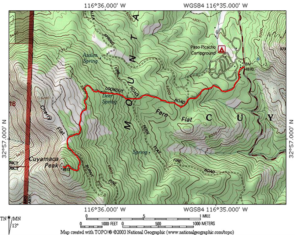
Several routes can be followed to the top of 6512' Cuyamaca Peak. One starts from the former Hual-cu-cuish Boy Scout Camp which burned down in a 2003 forest fire, one from Paso Picacho State Park Campground, one from Green Valley Falls State Park Campground.
The usual route is from Paso Picacho where you follow the paved road which leads to the Peak. At the time I was doing this hike there was a Fire Tower on the peak which is now gone.. This tower could be climbed and used as a view point, sometimes enjoying a visit with the person on watch during the fire season. In 2003 a large forest fire destroyed almost the entire Park.

Cuyamaca Peak Trail Map
Click here for more recent information on Cuyamaca Peak including an alternate route from Paso Picacho Campground.
I hiked to the peak as follows:
Date:
Winter 1958 (Use 2/1/58)
Summer 1958 (Use 6/1/58)
July 1959 (Use 7/15/59)
(February 21, 1960
March 20, 1960
November 12, 1960
April 22, 1961
November 11, 1961
May 13, 1962
November 18, 1962
May 18, 1963
October 2, 1966
Party:
Solo (first ascent)
Solo
Summer Camp group for pictures
Arroyo Seco Trail Camp only
Solo
Post 360 Coed (37 people) from Green Valley Falls Campground
Don Deck & Bill Paine
Post 360 Coed (15 people) from Paso Picacho Campground
Don Deck & Bob Brooks
Post 360 Camelback Hike - see Banner/Descanso
Post 360 Coed (21 people)
Don Deck, Steve & David Henderson, Brian Clark
Miles
6
6
3
5)
6
12
5
5
5
-
5
5
