On July 1-4, 1966 I climbed 13,289' Black Mountain on a 16 mile round trip backpack with Explorer Post 360 (17 boys, 4 men).
Black Mountain (great pictures) might be the most generic name for a mountain that someone could come up with. According to Wikipedia, there are over 100 peaks in California named Black Mountain. The Black Mountain on this trip is the highest of them all according to the Peakbagger database.
At 13291 feet, Black Mountain is situated on the Sierra Crest on the common border of Fresno County with Inyo County, as well as the shared boundary of John Muir Wilderness and Kings Canyon National Park. It towers nearly 10000 feet above the Owens Valley to the east.
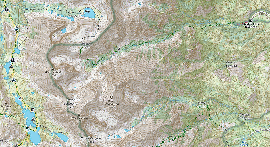
The mountain may be approached from several sides, the most direct route is from the Baxter Pass Trailhead just North of Independence which is the route we took. To reach this trailhead take 395 to a few miles North of the town of Independence. Turn off onto Oak Creek Road, bear left at the first split in the road, and head toward the Oak Creek Campground.
At the campground you will turn off onto a dirt road (that is usually well maintained) and follow this until you reach the trailhead. From the trailhead, the trail climbs up the canyon very steadily, crossing the creek several times, and finally bringing you to the basin below Baxter Pass (approximately 6 miles). From here the North and Northeast climbs of Black Mountain begin.
The first ascent of the summit was made in 1905 by George R. Davis, a USGS topographer. This mountain is habitat for the endangered Sierra Nevada bighorn sheep, which since 1995 is a restricted are which restricts climbing from July through December, so most ascents (now) are made in the spring.

Trail map to Black Mountain near bottom left
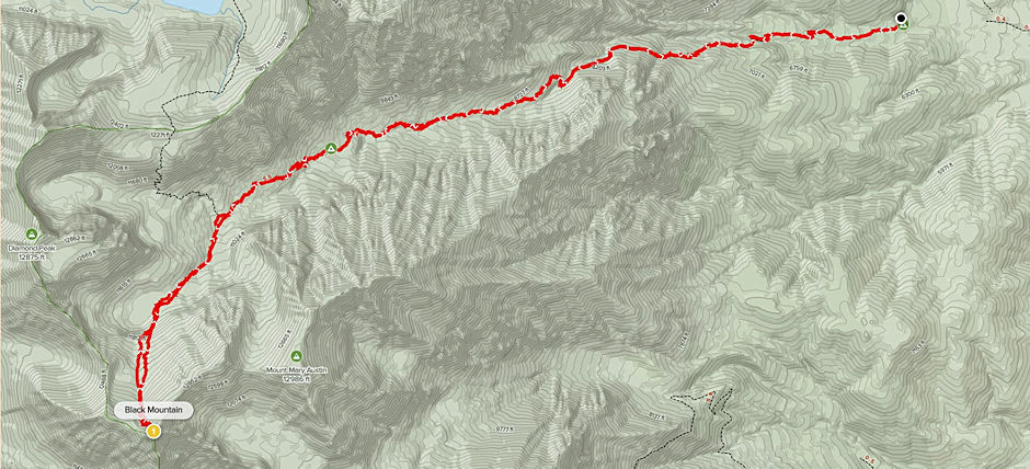
We started from the Baxter Pass trail roadhead at 7:30 a.m. - climbed via the trail 4500 feet from 6000 to 10500 for camp - last person in camp about 4 p.m.
Sunday 17 people climbed Black Mountain via north slope of east ridge - Class 2. Ridge can get Class 3 if you get on top too soon. Good views - can't see Rae Lakes - all on top by 12:30 after 7:30 start. In camp by 3:30 p.m.
Left Monday at 8:30 and made the cars about 11:00 a.m. Good trip.

Route to Black Mountain at bottom left
