Mount Carillon is a 13,559-foot-elevation mountain summit located on the crest of the Sierra Nevada mountain range in California. It is situated on the common border of Tulare County with Inyo County, as well as the shared boundary of Sequoia National Park and John Muir Wilderness.
It is set above the south shore of Tulainyo Lake, 12.5 miles west of the community of Lone Pine, 1.25 miles northeast of Mount Whitney, and 0.7 miles east-northeast of Mount Russell, the nearest higher neighbor. Topographic relief is significant as it rises approximately 5,180 feet above Whitney Portal in approximately two miles.
Carillon has subpeaks, unofficially called "The Cleaver" (13,383 ft, 0.4 mile to the northeast, and "Impala" (12,073+ ft), on the southeast ridge.
The first ascent of the summit was made in 1925, by Norman Clyde, who is credited with 130 first ascents, most of which were in the Sierra Nevada. The peak's name was submitted by Chester Versteeg of the Sierra Club, and officially adopted by the United States Board on Geographic Names in 1937. It is so named because it is shaped like a bell tower, which often houses a carillon.
Mt. Carillon is about 500' shorter than Mt. Russell. The East Face routes are steep and seldom climbed. Most summiters of Carillon ascend the South Slope routes, which are 2nd-to-easy 3rd class.
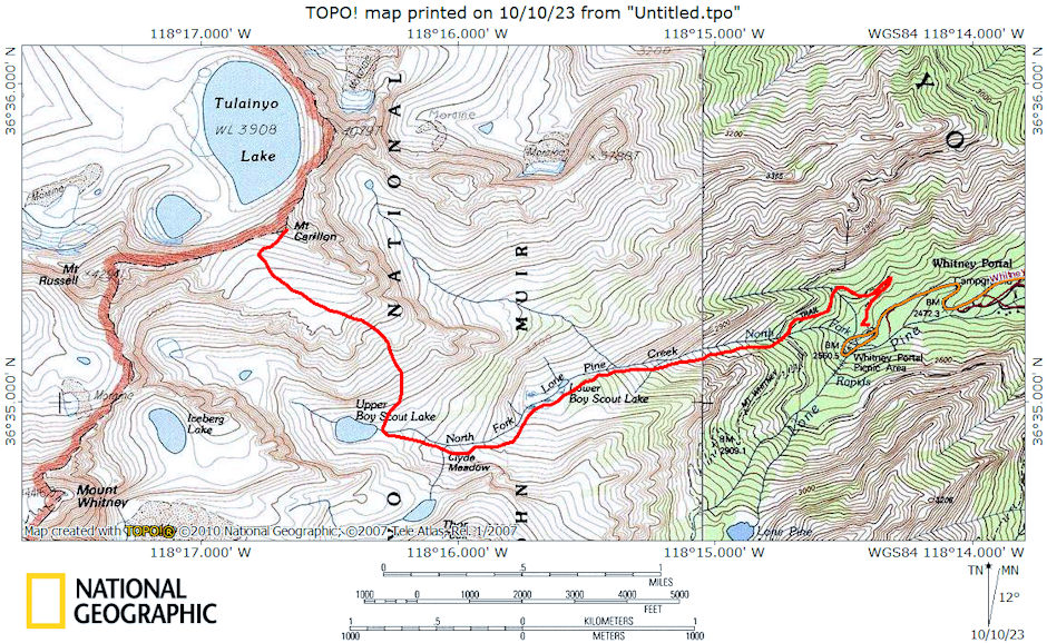
On April 29-30, 1972 I backpacked up the North Fork Lone Pine Creek with Gil Beilke, Karl Kohagen and Jim Bloom and climbed 13,553' Mount Carillon. Practically a trail beaten in now. Lower Boy Scout Lake very nice. Gil, Karl & Jim went on to "East Face" Lake to do the Mountaineer's route on Whitney. I went to Upper Boy Scout Lake to camp. Climbed Carillon - great views of Whitney, Russell, Lake Tulainyo.

Mount Carillon Route Map 1972
