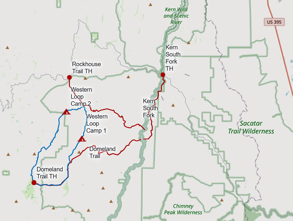
I made two backpack trips into the Domeland Wilderness. One from the west side of the Sierra via Lake Isabella and one from the east side of the Sierra via Rockhouse Basin.
The Domeland Wilderness is known for its many granite domes and unique geologic formations. This semi-arid to arid country has elevations ranging from 3,000 to 9,730 feet. Vegetation is mostly pinyon pine and sagebrush.
The Domeland Wilderness is located at the southern end of the Kern Plateau. This land was first protected by the Wilderness Act of 1964 as a 62,695 acre wilderness and was later expanded to 130,081 acres in 1984 to include the delicate transition ecosystems that meet to the east, south, and north of the original wilderness. These new additions, now jointly managed by the Bureau of Land Management and Sequoia National Forest, are rugged and dry. Because of its lower elevations, visitors especially enjoy this wilderness during the spring and fall seasons.
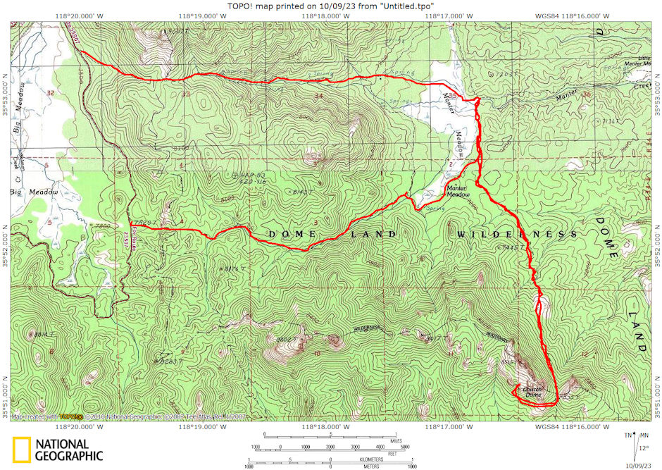
The first trip into Domeland Wilderness was 14 miles with Explorer Post 360 and 33 people on November 26-28, 1971.
We had an easy drive from San Diego to Lake Isabella and the Boulder Gulch Campground on Friday night. It was not too great a campground but served the purpose.
Saturday we had excellent roads to the trailhead at Big Meadow. Hiked easy 4 miles in on "southern" trail. Camped at lower Manter Meadow on Manter Creek - springs - good water - beautiful area - lots of wood.
Sunday we hiked trail to Church Dome - circled it but couldn't find easy route to top - requires rock climbing - should have rope. Others hiked down creek about 3 miles - nice country - camping - scenery. Others explored other areas. Hiked out via northern trail - 4 miles: good trail. Excellent area to visit again.

Domeland Wilderness Route 1971
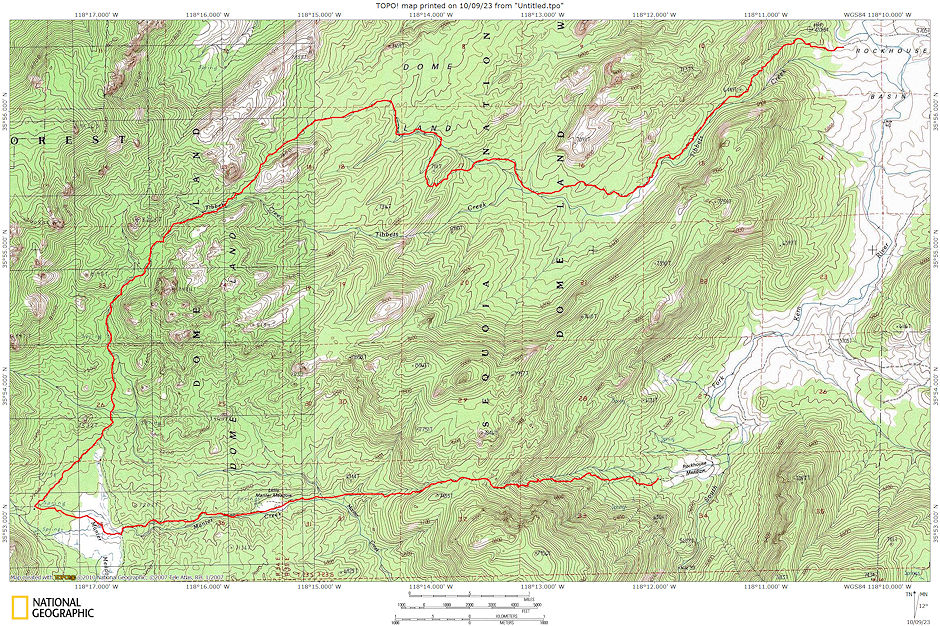
The second trip into DOmeland Wilderness was 18 miles with friends from Lone Pine and Independence Stan Haye, Al Nikolaus, Evelyn Nikolaus and Niki Nikolaus on April 30-May 1, 1977.
On Saturday we left Lone Pine about 6:15 am and drove to Rockhouse Basin. South Fork of Kern was low, so could drive across it and up to trailhead. Hit the trail about 9 a.m. Starts off with steep climb out of basin, then levels off in a valley along Tibbets Creek.
The trail was washed on steep hills and well blazed on trees. It is easy to lose after crossing to the south side of the creek - must watch for blaze on tree where creek turns into a dry sandy wash - or not cross creek in the first place.
The first creek crossing on the water comes and goes in the sand and rock. Found a nice spring and lunch stop about 4 miles in. Trail again climbs steeply, then levels some as it traverses around several drainages. About the time we topped out it started sprinkling off and on. We dropped to Manter Meadow and located the cabin used by owner of private property for cattle operation.
We used the cabin for cooking (and the nearby flush toilet), but slept out in tents. We made the cabin about 5 pm or so. During the evening the weather cleared, but in the early morning it came back in. Light snow flurries fell as we fixed breakfast and broke camp.
We left about 8 am, hiked across the meadow and started down Manter Creek. The lightly used trail was hard to follow in a few spots but very nice. We left the creek and climbed a steep trail to the ridge, for lunch and pictures - good views. The weather had broken up and it was nice and sunny though the breeze was chilly.
The trail down to Rockhouse Meadow is easy to follow but steep - not recommended for up travel. We made the meadow and South Fork Kern River about 1:30 p.m. and I hitched a ride back to the car. We were on our way home about 3 p.m. or so after a great trip - arrived Lone Pine 6 pm or so. This is a nice spring trip, although most years the river would be more of a problem to ford.

Domeland Wilderness Route 1977

