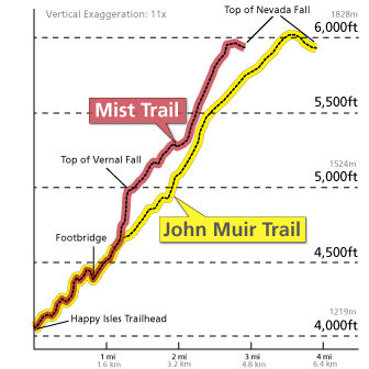
Vernal Fall is a 317-foot waterfall on the Merced River just downstream of Nevada Fall in Yosemite National Park, California. Like its upstream neighbor, Vernal Fall is clearly visible at a distance, from Glacier Point, as well as close up, along the Mist Trail.
The waterfall flows all year long, although by the end of summer it is substantially reduced in volume and can split into multiple strands, rather than a single curtain of water.
Nevada Fall is a 594-foot high waterfall on the Merced River in Yosemite National Park, California. It is located below the granite dome, Liberty Cap, at the west end of Little Yosemite Valley. The waterfall is widely recognized by its "bent" shape, in which the water free-falls for roughly the first third of its length to a steep slick-rock slope.
This mid-fall impact of the water on the cliff face creates a turbulent, white water appearance in the fall and produces a great deal of mist which covers a wide radius, which led to its current name (Nevada is a Spanish word meaning "snowy").
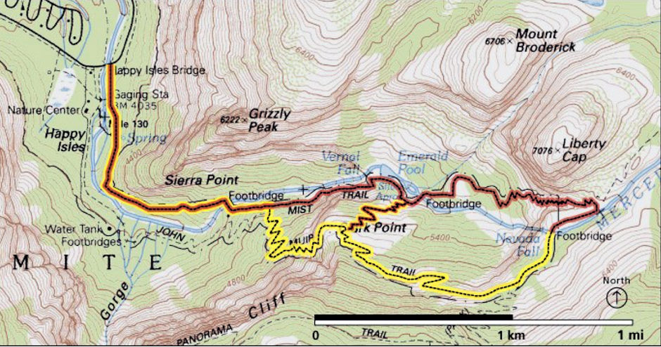
Click here for details on the trail. For numerous complete descriptions of the trail search for "Vernal Falls" on the Internet.

Vernal and Nevada Fall trail map
I apparently made a four mile round trip hike to Vernal Fall in Yosemite National Park on July 19, 1972 but didn't write any notes. I have visited both Vernal and Nevada Fall on numerous longer trips.
