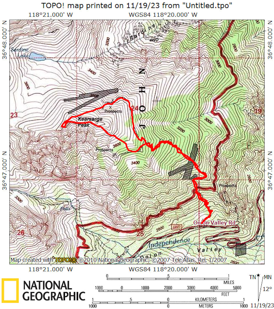
On July 18, 1976 I did a 5 mile round trip day hike climbing 12,598' Kearsarge Peak. Kearsarge Peak is located in the Sierra Nevada mountains of California. It lies east of the Sierra Crest not far from the Onion Valley/Kearsarge pass Trailhead, which is out of the town of Independence along the 395 highway. It's right at the edge of Owen's Valley, so there are pretty dramatic views up and down the valley. From certain angles, this mountain can resemble a pyramid when viewing from Owen's Valley. The view definitely makes you want to climb it!
I hit the trail at the bottom of the old tramway on Onion Valley road at 9 a.m. in cloudy weather. Ascended an old mining trail that was in good shape except for a few washed out places.
Found a stone house, partially collapsed with no roof where the trail crossed a ridge line. Later I missed the main trail by following the trail over a ridge toward the mines. After stopping at noon for lunch at some prospect holes at about 11,800', I hiked cross-country up the rock and sand slopes.
I found another stone house without roof on a ridge. It turned out that this was on the main trail which I followed down on my return. From here I followed the ridge, going up and down several false summits before spotting the real summit and staying down on the east slope until ready to ascend to the real summit.
I reached the summit about 2:45 after leaving my lunch stop about 1 p.m. and stopping briefly at the stone cabin. You can look down on the Rex Montis Mine road and facilities. I didn't go to the mines on the south side.
I found a register dating back to June 1975 and that two others had climbed the peak that day from Onion Valley. Another easy route is via the mine road up Sardine Canyon and to the Sardine Lake - then up the easy slopes to the peak.
It was very cloudy - occasional sun - but not very good picture taking weather - took some anyway. Left the top about 3:45 and made it to the car about 6 p.m. Should have taken two bottles of water. No shade worth mentioning - no water on route. A good hike for staying in shape - good views of University Peak.

Kearsarge Peak route map 1976
