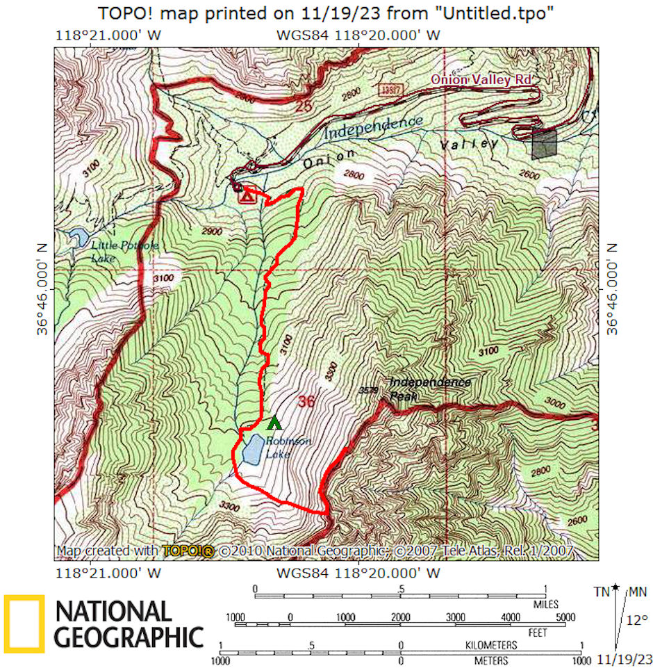
On July 25, 1976 Marty Nicolaus, Ralph Nicolaus and I set out on a 6 mile round trip day hike to climb 11,744' Independence Peak.
We left Independence about 8 a.m. and drove to the Onion Valley roadhead. About 9 we were on the trail up Robinson Creek, arriving at Robinson Lake about 10:45. After snacks we headed up the slopes into a prominent gully toward the upper end of the lake. We got into some third class climbing in a narrow gully, but worked out of it and soon made the ridge.
We worked our way along the ridge over 2nd and 3rd class - not bad but sort of frustrating and the peak kept appearing further out on the ridge. It turned out that we would have done better to go up the scree slopes or along the edge of the minor ridges from below the lake directly toward the summit. Except for the tiring scree, this would have been less difficult and the only third class would have been the final summit area.
As it was, we got to a false peak and the intervening terrain wasn't too inviting so we stopped short of the summit. If we had rested up and then proceeded, it would not have been all that difficult to drop down slightly, traverse over and up the peak. We decided the high point we reached was enough and it was noon so we ate lunch and relaxed.
The weather was cloudy and stormy over the Sierra Crest and we could see rain, hear thunder and once lightning. It was sunny most of the time until we finally decided to leave around 3 p.m. We descended easy scree slopes and made it back to the car shortly after 4. It was a good trip.

Independence Peak almost route map 1976
