On June 26-27, 1976 I backpacked up the Dana Fork of the Tuolumne River from the Tioga Pass road and explored the area around Parker Pass ... climbing Mt. Lewis, Parker Peak and Mt. Wood. About 23 miles round trip including the peaks.
On Friday June 25, 1976, after work, I drove from Independence to Tuolumne Meadows where I picked up a Wilderness Permit and stayed at the campground.
Saturday morning I got up fairly early and hit the Mono/Parker Pass trail about 7:30 a.m. About half way to Spillway Lake I got fairly close to two grazing deer.
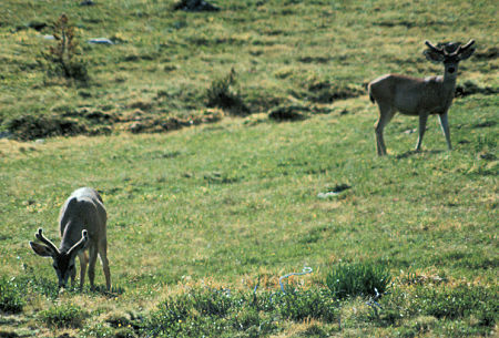
Deer along the trail up the Dana Fork from the Tioga Pass road
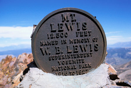
Marker on top of Mt. Lewis indicating the peak was named
after a Superintendent of Yosemite National Park
At Spillway Lake the trail disappears in the grass so I proceeded cross-country up gentle grassy slopes to Parker Pass, arriving about 10:30. I decided to camp just over the pass and climb Mt. Lewis, named after an early Park Superintendent.
I made the easy Class 1 peak about noon and enjoyed great views. After picture taking, checking out nearby areas with binoculars, sunbathing, etc. I followed the crest west toward Mono Pass for more pictures before descending to camp for supper. A brisk breeze blew until the sun went down, then it was calm all night.
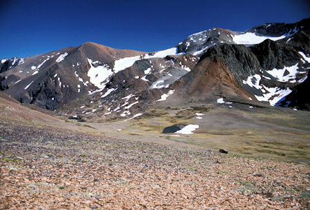
Mt. Woods way back just in from the left edge of the picture, Parker Peak is next, then Koip Peak Pass, then Koip Peak with the glacier below Kuna Peak to its right. Below is Parker Pass. Picture taken from the ridge leading to Mt. Lewis
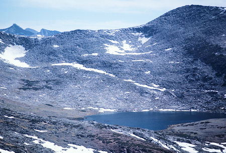
Helen Lake and the Kuna Crest from the ridge leading to Mt. Lewis
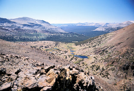
Looking northwest down the Dana Fork from the ridge leading to Mt. Lewis. Mono Pass is in the lower right corner. The larger lake is Summit Lake in Yosemite National Park
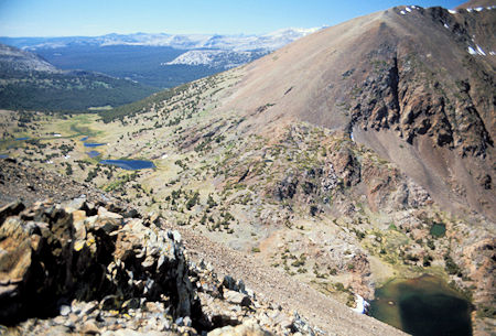
From the ridge leading to Mt. Lewis, looking northwest down the Dana Fork. Upper Sardine Lake is in the lower right of the picture, then moving left is Mono Pass and Summit Lake in Yosemite National Park. Flanks of Mt. Gibbs on the right.
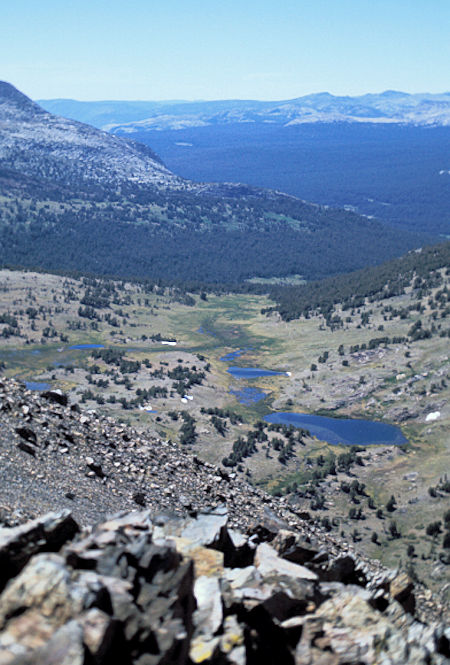
Looking northwest down the Dana Fork from the ridge leading to Mt. Lewis. Mono Pass is in the lower right corner. The larger lake is Summit Lake in Yosemite National Park
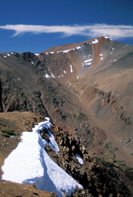
Mt. Gibbs from the ridge leading to Mt. Lewis
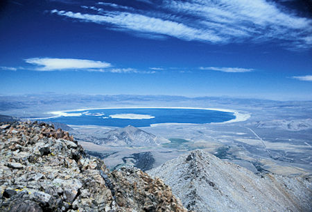
Mono Lake from Mt. Lewis
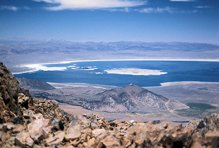
Mono Lake from Mt. Lewis

From the top of Mt. Lewis this panorama stitched together from five pictures shows Koip Peak Pass on the left edge, then Koip Peak, then Kuna Peak each with their glaciers. You then see the Kuna Crest with Helen Lake nestled in its basin and then Spillway Lake in the valley. Looking down the ridge from Mt. Lewis you see the Dana Fork and the forest east of Tuolumne Meadows. Next is the slopes of Mt. Gibbs with the pointy Mt. Dana behind on the right. June 26, 1976
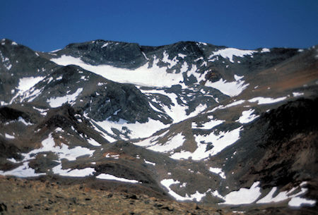
Kuna Peak with its glacier from near Mt. Lewis
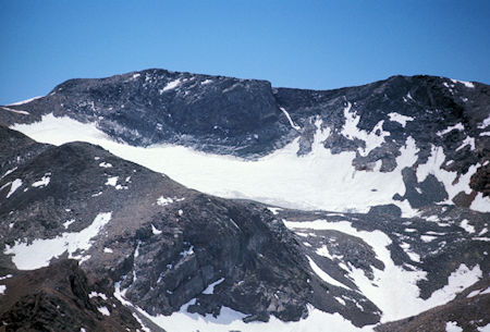
Kuna Peak with its glacier from near Mt. Lewis
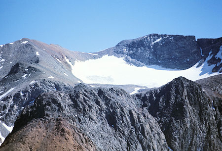
Koip Peak on the left and Kuna Peak with its glacier on the right from near Mt. Lewis
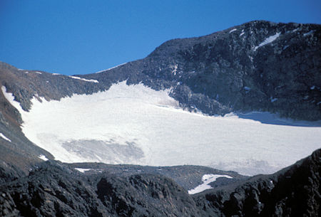
Kuna Peak with its glacier from near Mt. Lewis
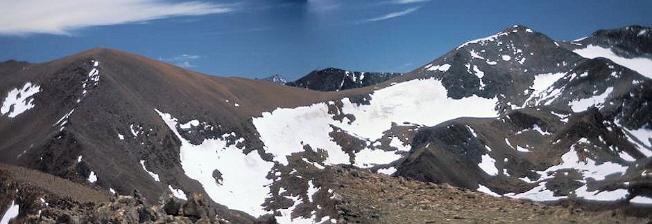
From Mt. Lewis, this panorama stitched from two pictures shows the rounded Parker Peak on the left, Koip Peak Pass, and Koip Peak with its glacier.
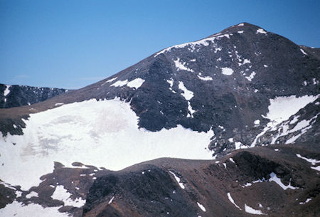
Koip Peak Pass on left edge of the picture, Koip Peak and its glacier on the right .. from Mt. Lewis
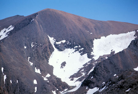
Looking at Parker Peak from near Mt. Lewis. the trail from Parker Pass switchbacks up the ridge in the lower left of the picture and then cuts across the face of the mountain above the snow fields to Koip Peak Pass
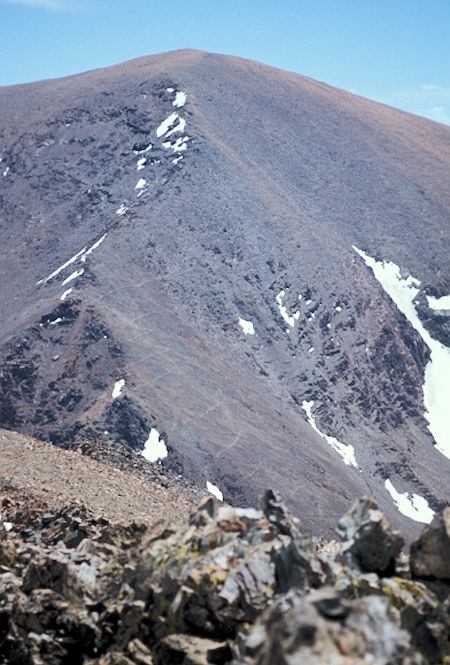
Looking at Parker Peak from Mt. Lewis. the trail from Parker Pass switchbacks up the ridge in the lower left of the picture and then cuts across the face of the mountain above the snow fields to Koip Peak Pass
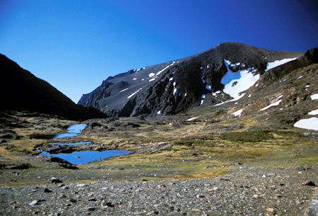
From Parker Pass the trail contours past a number of small ponds before climbing many switchbacks up the ridge toward Parker Peak and then traversing above the snow fields over to Koip Peak Pass to the right. The obvious deep canyon left of Parker Peak descends down Parker Creek to Parker Lake
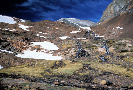
Looking up Parker Creek before going left to start the climb to Koip Peak Pass
I got up around 6:30 a.m. Sunday and after breakfast and packing, headed for Koip Peak Pass around 8 a.m., arriving about 10 a.m. I then climbed the easy Class 1 Parker Peak for outstanding views of Mt. Lyell, Banner/Ritter, etc. and the Alger/Gem Lakes - as well as views toward Tuolumne and Mt. Conness.
After much picture taking, etc. I left about noon and headed out the Class 1 ridge to Mount Wood with additional great views. More pictures, sunbathing, and it was 2 p.m. so I headed back to Parker Pass where I arrived about 4:15 after a rest at Parker Creek.
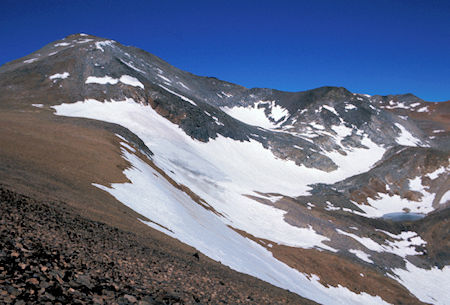
Koip Peak (at the left) and its glacier from near Koip Peak Pass
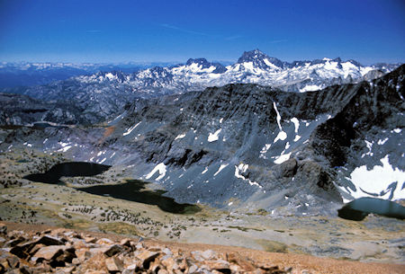
From Parker Peak you have this fine view of the Alger Lakes with Banner Peak and Mt. Ritter on the skyline just right of center. At the left side of the picture, behind the ridge, you can see Gem lake with its "bathtub ring" shoreline
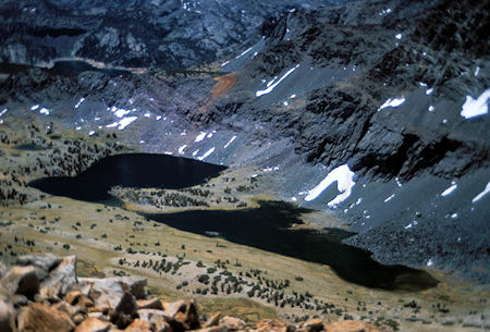
From Parker Peak you look down on the main Alger Lakes. At the left side of the picture, behind the ridge, you can see Gem Lake with its "bathtub ring" shoreline
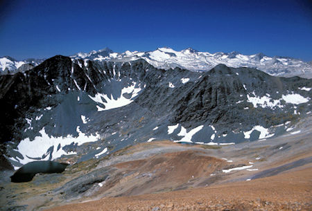
From Parker Peak you have this view looking southwest across the Koip Crest to Mt. Lyell and its glacier with Mt. Maclure to its right and Rodgers Peak to its left. The lake in the lower left corner is the Alger Lake just above the main lakes with Blacktop Peak above it
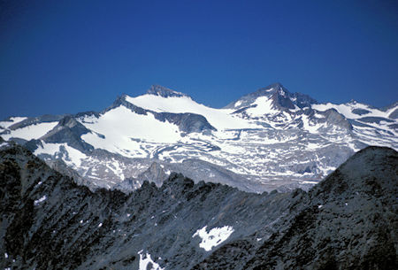
The magic of telephoto lenses give this view from Parker Peak of Mt. Lyell and its glacier on the left, Mt. Maclure on the right
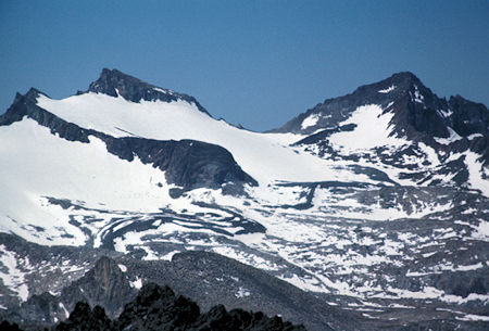
The magic of telephoto lenses give this view from Parker Peak of Mt. Lyell and its glacier on the left, Mt. Maclure on the right
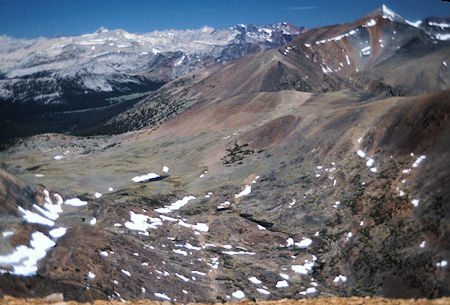
From Parker Peak you have this fine view northwest of the Dana Fork. The meadow in the far trees is Dana Meadows just inside Yosemite National Park near Tioga Pass. Below in the lower center is the string of small lakes going up and to the left to Parker Pass. The slopes to the right of these lakes lead to Mt. Lewis. On the right skyline the pointed peak is Mt. Dana and just in front of it is Mt. Gibbs
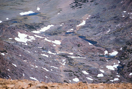
This closer view from Parker Peak shows the string of lakes below Parker Pass which is at the upper left edge of the picture
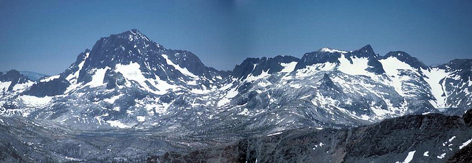
In this panorama of two stitched pictures from Mt. Woods you see Banner Peak and Mt. Ritter. The high peak at the left is Mt. Ritter in the background. Banner Peak is in the foreground to the left and is hard to distinguish since the colors blend together. A bit of Thousand Island Lake can be barely seen at the bottom of the peak. At the right edge you see the upper Davis Lake with Mt. Davis high on the skyline. June 27, 1976
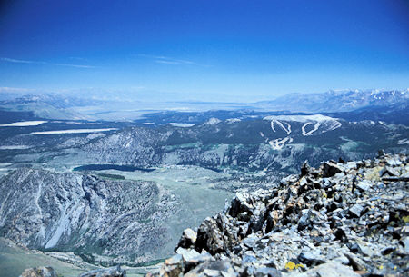
This view from Mt. Woods shows the June Mountain ski runs at the right and June Lake on the left with Crowley Lake beyond it
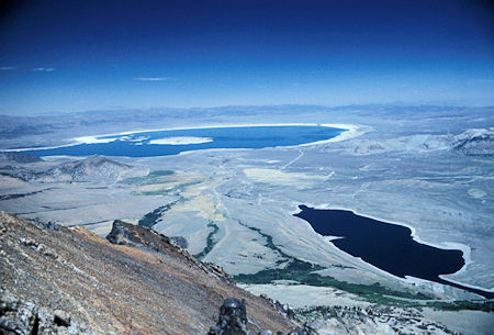
Mono Lake and Grant Lake from Mt. Woods
Shortly after 4:30, I hit the trail back to the car, arriving about 6:30. It was a great weekend, great weather, great views. I had hoped to climb Koip and Kuna Peaks but ran out of energy and time so will try to do them on a trip from Silver Lake to Alger Lakes later. See this July 11, 1976 trip for Koip Peak climb.