Wednesday, September 4, 1996
I headed for Harts Pass on the west side of North Cascade National Park and the Pasayten Wilderness under cloudy skies. I got to the Meadows Forest Service campground near Harts Pass about noon and it was COLD. The sun tried but finally gave up. About 4 p.m. it started snowing and after a while I decided to leave and go to a lower elevation where it would be warmer. It is only a 30 minute drive to come back.
Camped at the free River Bend Forest Service campground on the West Fork of the Methow River - much warmer but still rainy.
Thursday, September 5, 1996
The weather was supposed to improve for the weekend so I stayed put Thursday and read a book.
Friday, September 6, 1996
It was still cloudy and drippy. Took a six mile round trip hike up the West Fork Methow River Trail with some sun and sprinkles. I really wanted to get back to Harts Pass and do a couple of day hikes with fine views of the North Cascades.
Saturday, September 7, 1996
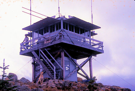
Lightning Bill & Lookout Turk await new visitors
at Goat Peak Lookout
I decided Harts Pass was a lost cause for now (I came back and explored the area in 1998), so drove to the trailhead for the Goat Peak Lookout. Trail information.
Weather still cloudy and drippy but decided to hike the 2.5 miles and 1000 foot gain anyway. Parts of the trail were really steep. Arrived on top about 11 and was greeted by Lightning Bill (the lookout) and Lookout Turk (the dog) and a nice warm lookout with wood fire in the stove.
Rising to a height of 7,000 feet, Goat Peak and its historic fire lookout comprise the most prominent landmark in the Methow Valley, visible from almost anywhere between Mazama and Winthrop. While the trail to its summit may inflict a little pain during its early steep stretches, you soon gain sweeping views from the floor of the valley to the tops of the airy summits of the North Cascades.
The trail begins in subalpine forest opening up to the occasional meadow of wildflowers. The trail follows a broad ridge, so every open space brings with it views to nearby peaks. In two thirds of a mile, you reach a steep section that is mercifully brief – after another two thirds of a mile and 800 vertical feet, attain a more pronounced ridge from which the lookout first comes into sight. From this vantage the lookout seems to tower over the Gardner Range to the south. A mostly level walk through windswept fields takes you to a final short climb. On the last turn before the summit, you’ll pass a massive cairn dedicated to the prior fire lookouts.
The summit is dominated, of course, by the lookout itself. While most of its brethren scattered across the state have long been rendered obsolete by observations from the air, it remains a working part of the forest fire detection system. For nineteen straight years, the lookout was staffed full-time during fire season by Bill Austin, who has developed a bit of a cult following as "Lightning Bill." In 2014, the decision to staff the Leecher Lookout outside of Twisp moved him further down the valley. The Goat Peak lookout is now on call, staffed when approaching storms warrant an extra set of eyes.
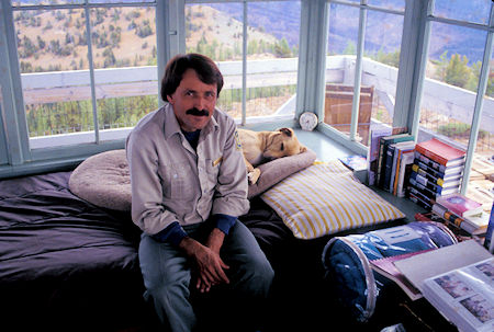
Lightning Bill & Lookout Turk in Goat Peak Lookout
"Lightning Bill" (Bill Austin) is quite a character. Born and raised in nearby Twisp. His father is a retired Forest Service employee.
He gets lots of visitors - over 800 this season (Has grown to 1500 by 2011). He takes a Polaroid picture of every visitor and gets them signed and dated and keeps them in an album for all to look at. He also has a globe on which he is marking the location that people are from.
He also writes poetry which he will read for you if you want. Very good. He really enjoys having visitors and is getting a reputation for his hospitality that is causing more people to visit.
Turk, the dog, also likes visitors and gets grumpy if their aren't any. People coming up the trail can be spotted about half a mile from the lookout. Turk goes down on the trail just below the lookout and sits there alert and pointing - waiting for the visitors to arrive.
I stayed for about 3 hours getting all dried out and warmed up and enjoying talking with Bill. I left when 4 more people were spotted en route.
Bill told me about a time he visited Caroline Lake (a place I had visited earlier) and watched a hawk swoop down and pickup a squirrel and fly out over the lake. The hawk dropped the squirrel into the lake and the squirrel swam like mad for the shore where he stood up and waved a mighty fist at the hawk.
It was interesting to watch the weather over the nearby mountains. The sun would break through, then be replaced by rain squalls, etc. It had snowed at the lookout Thursday and they had also had a wild lightning storm.
Read History Of Goat Peak Lookout.
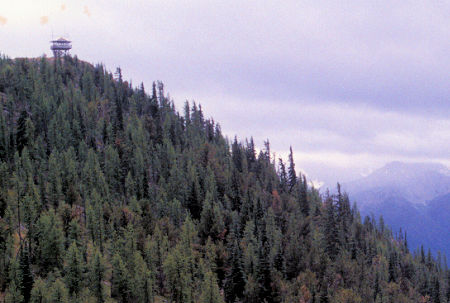
View from trail toward Goat Peak Lookout
near Winthrop, Washington
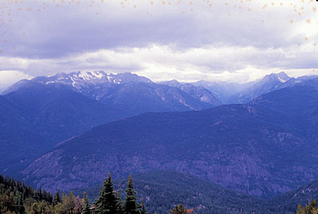
View toward North Cascades National Park from ridge
to Goat Peak Lookout near Winthrop, Washington
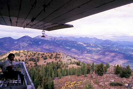
Lightning Bill and scene along ridge at Goat Peak Lookout
near Winthrop, Washington
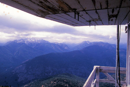
View toward North Cascades National Park
from Goat Peak Lookout near Winthrop, Washington
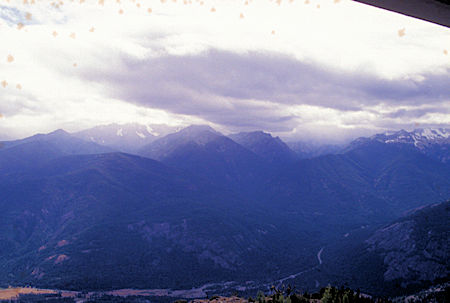
Toward southern North Cascades National Park
from Goat Peak Lookout near Winthrop, Washington
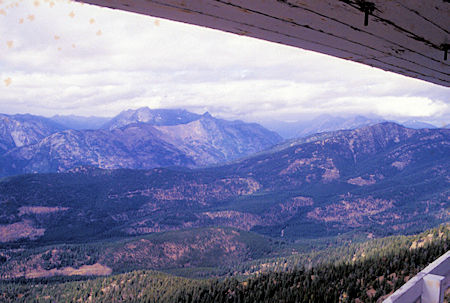
Toward Paseyten Wilderness
from Goat Peak Lookout near Winthrop, Washington
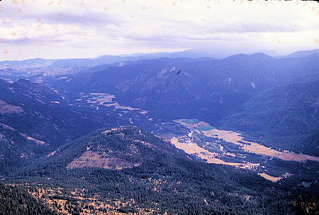
Toward southeast Methow Valley from Goat Peak Lookout
near Winthrop, Washington
Goat Peak Lookout - Joe Hendricks - 2016
From the lookout trailhead I drove to the Chewuck River Campground on the Chewuck River north of Winthrop, WA.
Sunday, September 8, 1996
I drove a short distance to the Lake Creek trailhead and hiked to Black Lake in the Pasayten Wilderness. Very nice trail with not a lot of elevation gain. The weather alternated between sprinkles and sun. The lake is about 4000 feet and very nice.
Met two men from Whidbey Island. One owns a print shop, the other a Radio Shack. They had been there since Thursday and had a nice fire going that warmed me and dried me out. Shortly after I arrived one of them caught a nice rainbow trout. Just before I left an hour later the other one caught a similar sized trout. Good sized - big by Sierra standards.
They had five on a stringer the night before that they planned to have for breakfast but a Raccoon (or family of) got to them during the night. Sooo, they had steak for breakfast. They had packed in one day, then hiked out and made a second trip to bring in the steaks, etc. They come to this lake every year and were having a fine time.
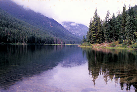
Black Lake, Pasayten Wilderness, north of Winthrop, Washington
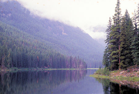
Black Lake, Pasayten Wilderness, north of Winthrop, Washington
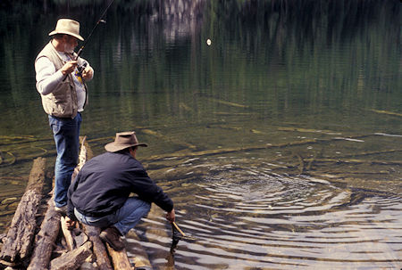
Whidbey Island print shop owner and Radio Shack owner
hook a trout at Black Lake, Pasayten Wilderness,
north of Winthrop, Washington
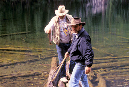
Whidbey Island print shop owner and Radio Shack owner
land a trout at Black Lake,Pasayten Wilderness,
north of Winthrop, Washington
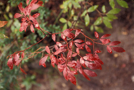
Colorful leaves on Lake Creek Trail to
Black Lake,Pasayten Wilderness, north of Winthrop, Washington
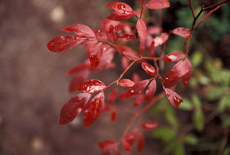
Colorful leaves on Lake Creek Trail to
Black Lake,Pasayten Wilderness, north of Winthrop, Washington
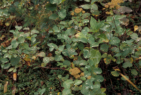
'Diamonds' (water drops) on leaves on Lake Creek Trail to
Black Lake,Pasayten Wilderness, north of Winthrop, Washington
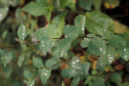
'Diamonds' (water drops) on leaves on Lake Creek Trail to
Black Lake,Pasayten Wilderness, north of Winthrop, Washington
I had kind of been hoping the weather would clear up as had been predicted. Locals said that September was usually nice - in fact, last year it was hot and dry. I was still hoping for better weather so I could return to Harts Pass but it didn't look likely so I headed east for Okanogan and on to Omak where I got a motel room.
Monday, September 9, 1996
The forecast was for sunny weather for a few days then more rain. I drove north to Tonasket, then west to Loomis and then headed up into the forest toward the Pasayten Wilderness on a well graded and paved full width logging/recreation road. Saw a few people gathering firewood for the coming winter. The pavement ended but the full width graded gravel road continued on for several miles to a gate.
According to the map the road continued on for about three miles. There was a trailhead at the gate and I thought about hiking up to Windy Peak the next day. About seven miles and 2500 foot gain. I checked out the first mile or so of the trail and decided I really wasn't interested in that much work for minimal views.
Drove back down the road to Long Swamp Forest Service Campground for the night. Took advantage of the sun to dry some of the dampness out of the International.
About dusk three mountain bike riders showed up. They were from Seattle and had flown in to the area and been riding all day. Lost a spoke which had delayed them a bit. They were on a five day trip.
While discussing the area they mentioned that they had talked to the Forest Service about the road beyond the gate. Seems the terrain is such that it would cost a million dollars a mile to complete the remaining about three miles or so to tie in with the Chewuck River road so it was unlikely to ever be built.
Tuesday, September 10, 1996
Awoke to an icy morning with frost on everything. Definite signs of fall.
After a leisurely morning I drove back to Loomis and Tonasket, then continued on scenic State Route 20 to the east over Sherman Pass to Kettle Falls.
Along the way I stopped at several view points and at a historical trail site.
The trail takes you around some remnants of early logging days. Included ditches where logs had been dragged by animals, flumes where logs had been floated down to the railroads, and right-of-way where once a railroad had run.
Was quite a serious undertaking back in the early 1900's.
Crossed the Columbia River at Kettle Falls and continued on Highway 20 to the Pend Oreille River where I turned north to Metaline Falls and a campground at Sullivan Lake in the Colville National Forest.
A nice quiet little fishing lake with a Forest Service dirt runway airport. The country side is this area is mostly forested mountains - nothing spectacular.
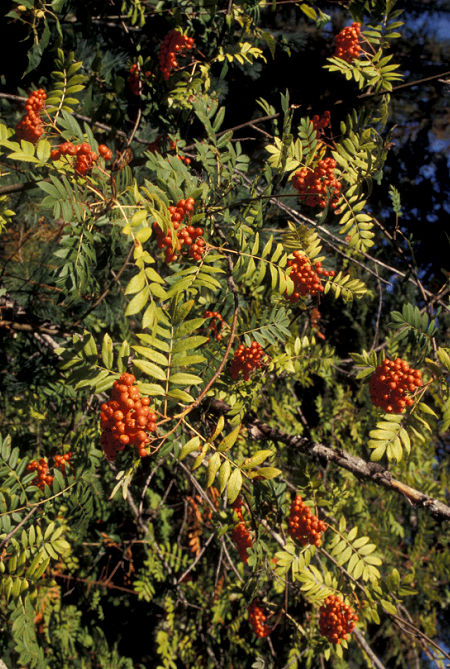
Ripe berries at Sullivan Lake near Metaline Falls, Washington
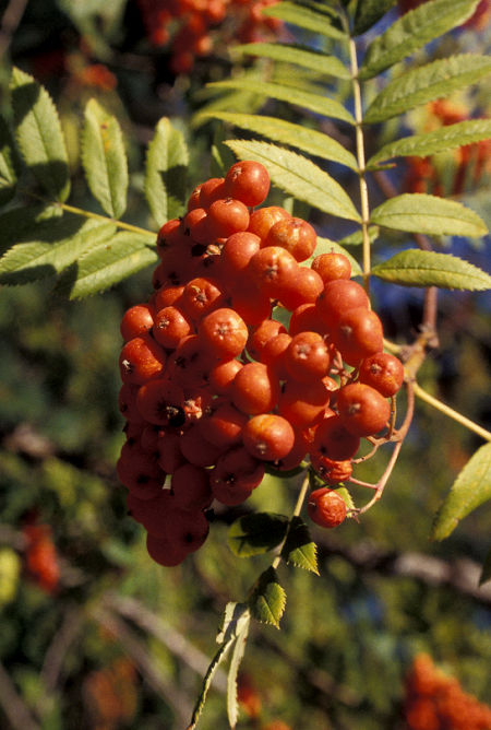
Ripe berries at Sullivan Lake near Metaline Falls, Washington
Wednesday, September 11, 1996
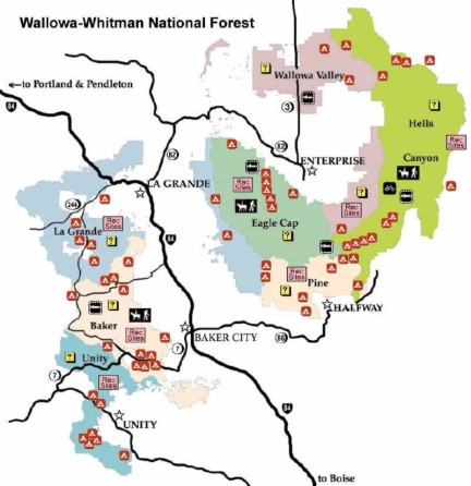
Headed south back to Highway 20 along the Pend Oreille River to Newport, then east on US 2 to Sandpoint, Idaho and Pend Oreille Lake.
Proceeded south on US 95 to Coeur d'Alene for lunch, then on to Clarkston and Lewiston across miles and miles of wheat fields on a great plateau.
All of a sudden the land drops deeply into the Snake River at Lewiston, Idaho - very dramatic.
On the way down the hillside I stopped at a viewpoint. A car was there with it's hood up and the lady driver approached me and asked if I had a telephone.
She was from Lewiston and her car was completely broken down - she asked me to call her father when I got to town and tell him she needed a tow truck.
When I got to Lewiston, I stopped for gas and to make the call. There happened to be a Lewiston Policewoman getting gas so I turned the phone call over to her since she could follow up if no one was home.
I continued on Washington State Route 129 up out of the Snake River canyon onto the continuing plateau and more wheat fields. The scenery soon changed to forest and at the Oregon border the route became Oregon State Route 3 and took me to Enterprise, Oregon.
I turned west on State Route 82 to the town of Lostine, then south along the Lostine River deep into the Eagle Cap Wilderness - some pretty impressive mountains sticking up out of the plain. I found a nice free Forest Service campground in the Wallowa-Whitman National Forest for the night.
Thursday, September 12, 1996
I headed back to Enterprise for groceries, then on through Joseph and turned off onto a road that follows Little Sheep Creek down to Imnaha on the Imnaha River.
I then proceeded on a steep narrow gravel road up the east side of the canyon onto a ridge leading out to 6.892 foot Hat Point which has a Fire Lookout and views of the Snake River and Hells Canyon.
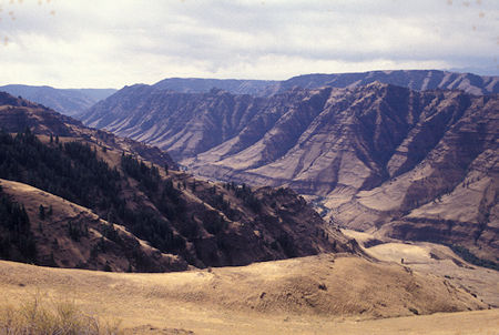
Imnaha River Valley from road to Hat Point,
Hells Canyon National Recreation Area, Oregon
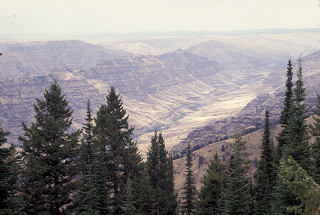
Imnaha River Valley from road to Hat Point,
Hells Canyon National Recreation Area, Oregon
Fortunately I didn't meet much traffic coming down the narrow road. Great views of the peaks and canyons in the area.
Passed a dirt runway Forest Service airfield with a small airplane parked, then three men backpacking up the road. They had flown in from Seattle and were going to hike down into Hells Canyon and the Snake River, then back up.
When I got to Hat Point I could see the trail winding down into the canyon. This is all inside the Hells Canyon National Recreation Area so there are picnic facilities at the point, and the lookout can be climbed to a lookout platform below the fire lookout on top.
The public is allowed limited access to the top when someone is on duty (which wasn't the case today).
I had lunch and then headed back down the road. As I passed the airfield a helicopter was hovering over the field picking up a sling loaded with what looked like bags of cement. Apparently a construction project was going on somewhere nearby.
About half way down the steep narrow exposed portion of the road I met a man driving a pickup towing a cargo trailer with a motor trail bike in the back. He apparently was local and possibly going in to do some hunting.
I pulled over as far as possible on the inside side of the road (thank God) while he pulled up beside me on the outside edge. There was adequate room for the two vehicles side by side, but he was concerned that his trailer, which was home made and had wider than usual wheels, might drop a wheel off the edge of the road. Fortunately all went well.
At Imnaha I turned south on a well graded gravel road along the Imnaha River. Numerous small farms along the route. It was interesting that each time the road passed a house, it was paved - apparently to keep traffic from generating dust that would drift into the homes.
Mid-afternoon I came to a Fish Weir operated by Oregon Fish and Wildlife to capture Salmon which are then milked for fish eggs. These are raised in a nearby hatchery and then returned to the Imnaha River - all part of major efforts to restore and maintain the native Salmon fishery in the Snake River drainage.
I was a few days too late to see any fish in the weir, as the trapping period had passed. Had an interesting talk with the Fish and Game man who was both visitor host and busy cleaning/sanitizing the facilities to be ready for the next season.
I soon arrived at a paved road and took a side trip to another Hells Canyon viewpoint which had good views of the canyon except that you couldn't see the river. I back tracked to the Imnaha River and found a free Forest Service campground for the night.
Friday, September 13, 1996
Headed south on paved roads to the small town of Halfway for gasoline, then headed east to Oxbow on the Snake River and took the private paved power company road north down the river to the Hells Canyon Dam. You can drive across the dam to the small Forest Service Hells Canyon Creek Visitor Center with launching facilities for trips on the Snake River. During the main tourist season both jet boat and rubber raft trips are available here.
When I got to the visitor center, a private party was assembling two rubber rafts for a trip. I stayed around a watched them for a couple hours until they actually headed down the river. As I was taking pictures one of them invited me to go along.
My roll of film from this year got lost in the mail. I returned here in 1997 and got some pictures.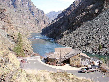
Hells Canyon Visitor Center - USFS Photo
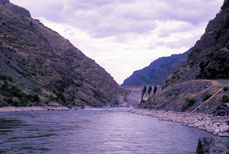
Looking up the Snake River toward Hells Canyon Dam - 1997
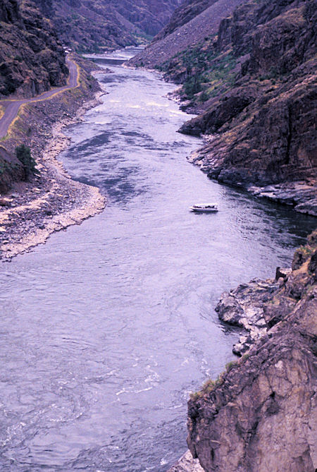
Jet Boat on Snake River from Hells Canyon Dam - 1997
After lunch I headed back via paved forest roads toward Joseph and Enterprise. Nice forested drive, part of it though an old forest fire burn. I continued on to Lostine and up the Lostine River to the same campground (and same campsite) I stayed at two days ago.
Saturday, September 14, 1996
I had considered taking an overnight or day hike into the Eagle Cap Wilderness following a route described in a magazine article I had saved years ago. During the evening there was a lot of traffic including large horse trailers headed on up the river to the trailhead.
I decided it must be the opening of hunting season - or something to make the area very popular for this weekend - and began to think it was going to be more crowded than I would like.
Turned out that in the morning it was raining and heavy clouds so my decision not to do the hike was easy <grin>. Instead, I returned to Lostine and headed west on State Route 82 to La Grande, then south on Interstate 84 to Baker.
From Baker I took scenic State Route 7 south and west into the Sumpter Valley - a historic mining and timber area.
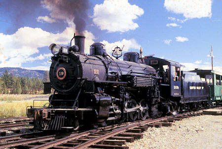
Sumpter Valley Narrow Guage Railroad - 1996
An extensive railroad system once extended from Baker into this forested area for logging and other purposes.
Gold dredges once worked there way up and down the river.
Between McEwen and Sumpter, a volunteer organization during the past twenty years, at the time of my visit, has reconstructed about five miles of the original narrow gauge railroad.
They have retrieved three functioning engines (two of them from Alaska) and some cars - including a rather nice passenger car.
The Sumpter Valley Railroad offers rides on this train during summer on weekends. Only eight dollars round trip.
At the McEwen end is their shop and other facilities, including a collection of parts.
Click for more Sumpter Valley Narrow Guage Railroad including 2019 updates
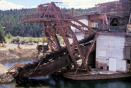
Sumpter Valley Gold Dredge - 1996
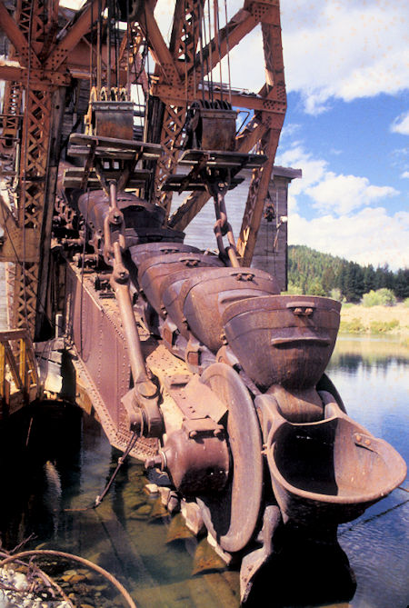
Sumpter Valley Gold Dredge - 1996
At the Sumpter end is a fairly new Sumpter Valley Dredge State Heritage Area built around the last dredge that worked the river. At the time of my visit the dredge was being restored and would soon be open to the public.
I spend a couple hours checking all this out, talking with some of the group members and taking pictures.
Click for more Sumpter Valley Dredge
Around 2 p.m. I headed south to US 26, west to Prairie City and John Day where I hooked up with old familiar US 395. This pleasant forested route continued south to Burns where I checked into a motel.
Sunday, September 15, 1996
Woke up to rainy skies as I got an early start on the final leg home. Much of the first part of the drive was miles and miles of just miles and miles. Lots of wide open spaces with few people and almost no traffic.
It rained off and on - showers and downpours with occasional sun. As I got further south the terrain got more interesting and the mixed weather actually enhanced the scenery.
I passed the giant Goose Lake as I crossed into California and shortly arrived at Alturas rejoining the route I had followed going north in June. The rain continued with some really heavy downpours but none lasted very long.
As I drove into Susanville for lunch the rain showers were evident all around me but it was not raining in town. It looked like the Sierra was getting a lot of moisture but I only had a few sprinkles the rest of my drive home.
As I passed through Reno it looked like I would be home around dusk. The mixed sun and clouds made for a very pretty drive. As I came over the hill on Conway Summit and headed down past the Mono Lake viewpoint a beautiful rainbow appeared. My brain suddenly said STOP, take a picture.
Unfortunately by the time I did stop, backed up into the viewpoint and got my camera out, the rainbow had faded too much to photograph. It was still a neat scene.
As I passed Mammoth on the final leg home, a BIG BLACK CLOUD had settled in over Mammoth and it looked like the end of the world was coming. Nothing serious was apparently happening but it was surely impressive.
I rounded the corner on Owens Gorge Road just as the sun was setting over the Sierra. It was great to be home after 98 days on the road, 7600 miles of driving, 200 miles of hiking and 950 pictures to record the journey.


