Sunday, June 28, 1998 (Continued)
Headed out on Highway 97, now the Alaska Highway. Visited the original Kiskatinaw River curved bridge - now off the main rerouted highway.
The Historic Kiskatinaw Bridge is located about 30 km north of Dawson Creek, BC within Kiskatinaw Provincial Park (established 1 May 1962). Built in 1942-43 by the US Public Roads Administration (PRA) to replace the original timber trestle, the bridge is a curved, timber-truss structure about 122 m in length.
This three-span timber truss bridge has an amazing nine-degree curve – a curve that engineers designed to accommodate the highway's steep change in grade on the west end and the need to land at a notch in the cliff on the east end. At the time, it was the first wooden curved bridge to be built in Canada.
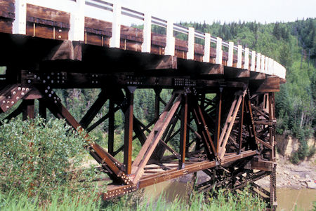
Kiskatinaw curved Bridge, British Columbia
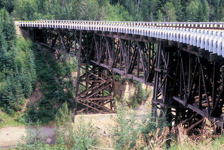
Kiskatinaw curved Bridge, British Columbia
Stopped in Fort St. John and visited the Fort St. John-North Peace Museum which had some very nice historical displays. Not very large but worth seeing.
Stopped at the Buckinghorse River Provincial Park for the night.
Monday, June 29, 1998
Had a nice sunset - around 10 p.m. I think - and awoke to a high overcast.
Proceeded north to Fort Nelson - skipped the museum - I've seen enough heritage history for a while - GRIN -.
Just north of Fort Nelson the highway was pretty bad with lots of loose gravel patches. One car coming toward me was driving too fast and threw rocks all over the place - one got my windshield on the far right - another inch to the right and it would have missed. The crack is not a problem. I also got hit by a rock last year on a highway. Figured I would have to replace the windshield sometime after Alaska anyway.
Had several construction stops. They have rebuilt much of the highway to relatively modern standards - wide with shoulders - high speed curves - gentle grades. The new construction is doing the same to parts of the highway that still follow the original route. The driving has not been bad anywhere so far.
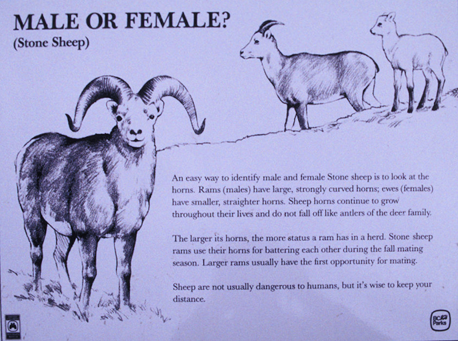
Crossed Summit Lake Pass, 4250 feet, highest point on the Alaska Highway. Just north of the pass and at several spots on down the highway saw bunches of Stone Sheep grazing by the highway. Stopped several times for pictures.
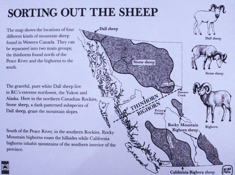
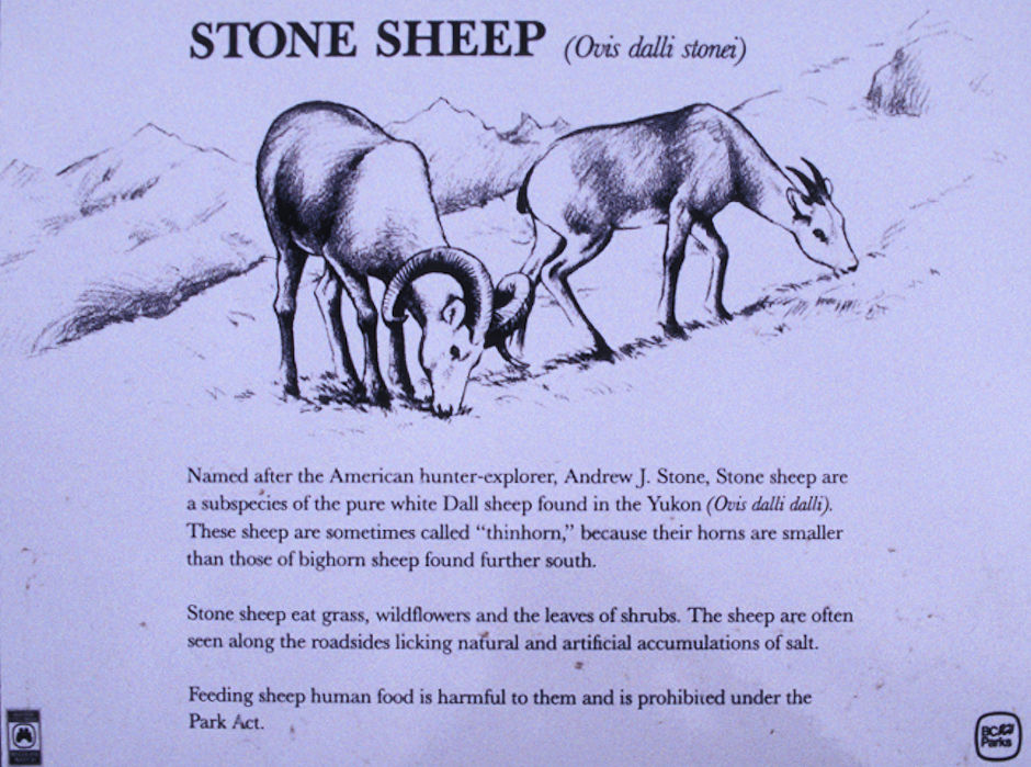
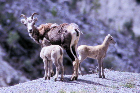
Stone Sheep near Summit Lake Pass, British Columbia
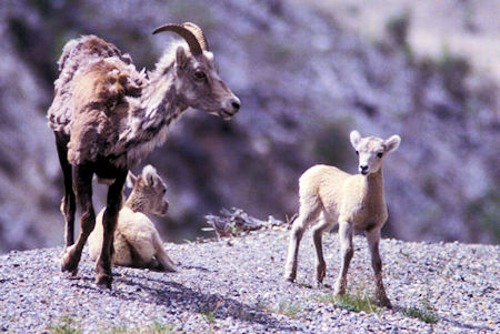
Stone Sheep near Summit Lake Pass, British Columbia
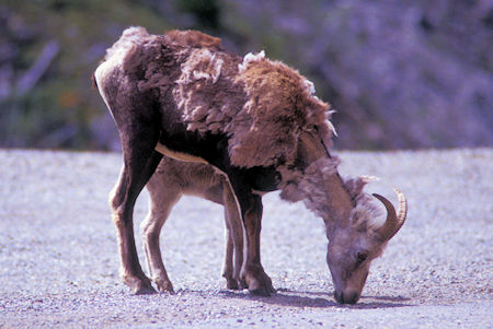
Stone Sheep near Summit Lake Pass, British Columbia
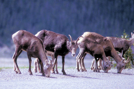
Stone Sheep near Summit Lake Pass, British Columbia
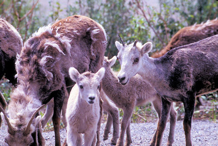
Stone Sheep near Summit Lake Pass, British Columbia
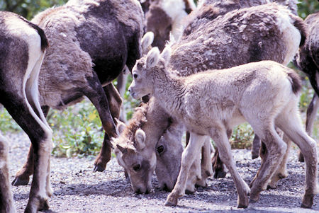
Stone Sheep near Summit Lake Pass, British Columbia
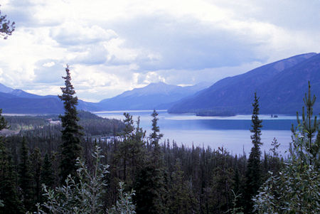
Muncho Lake Provincial Park, British Columbia
Stopped at viewpoints along the shore of Muncho Lake - at 7.5 miles long, one of the largest in the Canadian Rockies.
The lake is part of the Muncho Lake Provincial Park and located at mile 423 of the Alaska Highway. The lake is about 7.5 mile long and its width varies between 1 and 6 km. It reaches a maximum depth of 732 feet.
The surrounding peaks (the Terminal Range of the Muskwa Ranges to the west and the Sentinel Range to the east) reach altitudes of more than 6,600 feet, while the lake lies at an elevation of 2,690 feet. It is formed along the Trout River, a tributary of the Liard River.
The jade green color of the lake is attributed to the presence of copper oxide leached from the bedrock underneath. Its name is derived from the Kaska language in which "muncho" translates as "big water".
Was going to stop at the Laird River Hot Springs Provincial Park but the campground was full. The hot springs make it popular.
So I continued on and finally stopped at an unimproved "parking spot" at Contact Creek.
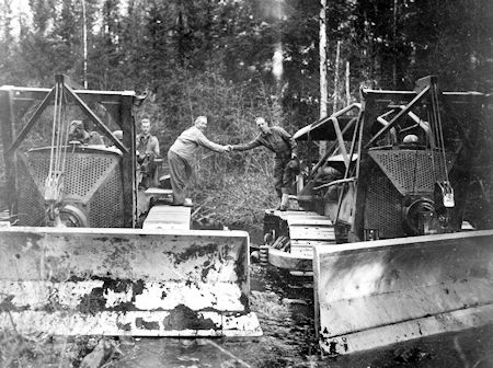
35th and the 340th Army Engineers met at Contact Creek
On September 24, 1942, at 5 pm, the 35th and the 340th Army Engineers met at Contact Creek. Colonel Lyons and Major McCarty, climbed onto bulldozers to have their picture taken. The Alaska Highway was open from Dawson Creek, British Columbia to Whitehorse, Yukon Territory.
Tuesday, June 30, 1998
Beautiful SUNNY day. More road construction - none of it has been a problem.
Arrived at Watson Lake, Yukon Territory located at mile 635 on the Alaska Highway close to the British Columbia border.
The town is named for Frank Watson, an American-born trapper and prospector, who settled in the area at the end of the nineteenth century.
Watson Lake is the home of the famous Watson Lake Signpost Forest which was started in 1942 by a homesick U.S. Army G.I. working on the Alaska Highway, who put up a sign with the name of his home town and the distance. Others followed suit and the tradition continues to this day.
It has really grown - well over 26,000 signs (as of 2013 over 72,000 signs) - it would take several days to check them all out - I did find Santee, CA, Town of Bridgeport, and several other familiar places. One lady was here for the sixth time and was having trouble finding the sign they had left on a previous trip - the number of signs had grown so much.
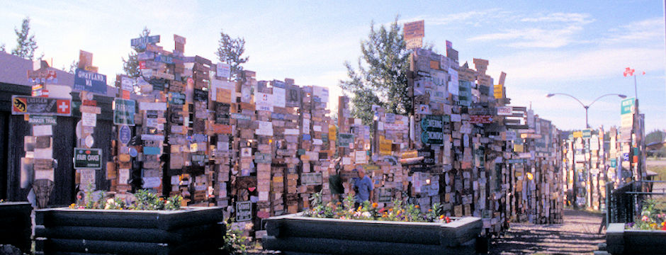
Signpost Forest 1998, Watson Lake, Yukon Territory
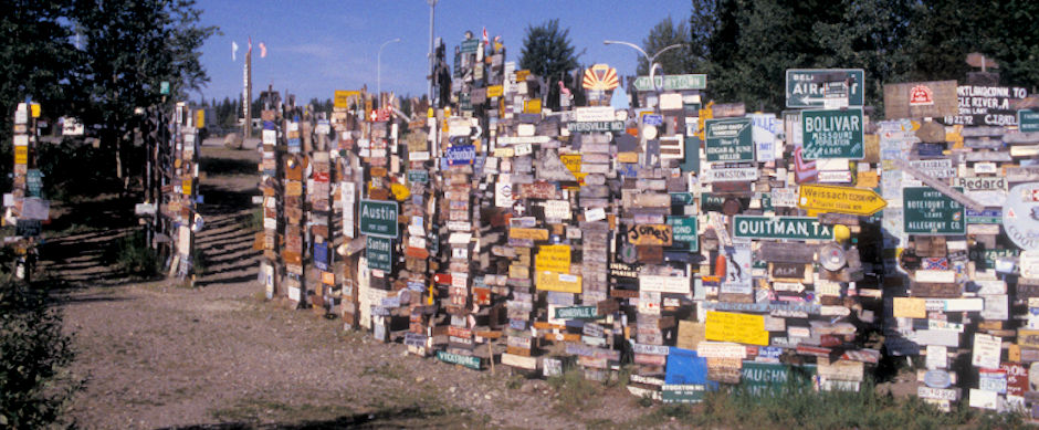
Signpost Forest 1998, Watson Lake, Yukon Territory
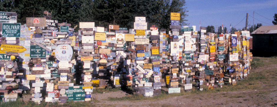
Signpost Forest 1998, Watson Lake, Yukon Territory
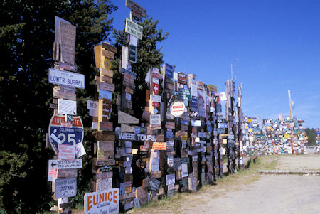
Signpost Forest 1998, Watson Lake, Yukon Territoryy
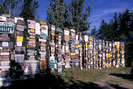
Signpost Forest 1998, Watson Lake, Yukon Territory
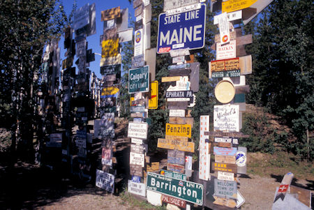
Signpost Forest 1998, Watson Lake, Yukon Territory
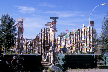
Signpost Forest 1998, Watson Lake, Yukon Territory


